
 v1.0.1
flutter_image_map
Bildkarte, erstellen Sie Bereiche mit anpassbaren Farben auf einem Bild und reagieren Sie auf Klicken/Tippen. Genau wie bei HTML.
26Likes 25130-Tage-Downloads150Pub-Punkte
AndroidiOSWebmacOSWindowsLinux
itzMeerkat/flutter_image_map open-source repository details.

{"sdk":"flutter"}^2.0.0^2.0.2Englischer Projektschnappschuss. Aktuelle Inhalte auf GitHub.
A simple but (hopefully) useful package that implements the HTML image map standard.
Originally introduced in HTML 3.2 as a replacement for server side imagemaps. Server side image maps were clunky requiring a round trip to the web server to determine where to go based on the coordinates clicked in the image. Thus client side image-maps were born!
An imagemap is a graphic image where a user can click on different parts of the image and be directed to different destinations. imagemaps are made by defining each of the hot areas in terms of their x and y coordinates (relative to the top left hand corner). With each set of coordinates, you specify a link that users will be directed to when they click within the area.
As an example, say you have a map of the World that you wish to act as an image map. Each country could have their hot areas defined on the map to take you to different pages.
Check out the Example project for a full example code of all the differents ways to define image map regions.
Select an image image
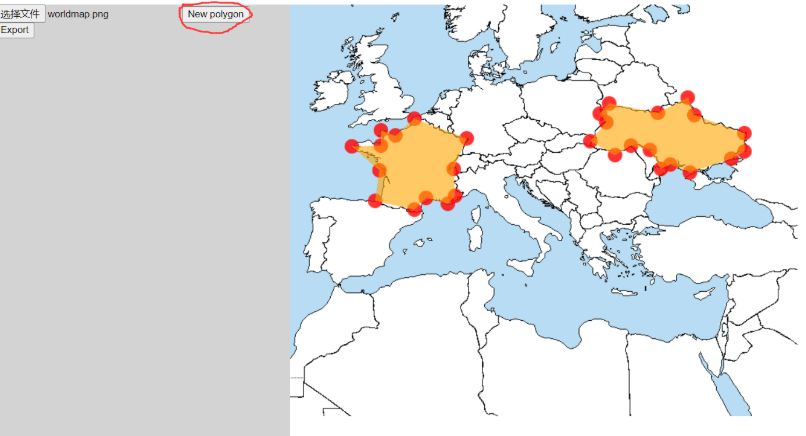
Click on the image to add vertices of ROIs image
If you want to create a new ROI, click on "New Polygon" image
When you are done, press "Export" image
It will pop up a dialog image
The format of the data is:
List<List>, each sub-list describes a polygon. To adjacent numbers represent a position.
e.g.
[
[x1,y1,x2,y2,x3,y3,...],//Polygon 1
[x1,y1,x2,y2,x3,y3,...],//Polygon 2
[x1,y1,x2,y2,x3,y3,...],//Polygon 3
]