
 v8.3.2
flutter_map
Flutter 的首选非商业地图客户端:易于使用、功能多样、无供应商依赖、完全跨平台,且 100% 纯 Flutter
2180喜欢 82.5万近 30 天下载160Pub 分数
AndroidiOSWebmacOSWindowsLinux
用于收集公共交通中符合OpenStreetMap标准的无障碍数据的应用程序
 v8.3.2
Flutter 的首选非商业地图客户端:易于使用、功能多样、无供应商依赖、完全跨平台,且 100% 纯 Flutter
MobX 的 Flutter 集成。它提供了一组 Observer 小部件,当跟踪的可观察对象发生变化时会自动重建。
MobX 是一个用于响应式管理应用程序状态的库。使用可观察对象、动作和反应的力量,为您的 Dart 和 Flutter 应用程序赋能。
Flutter 的地理定位插件。此插件为通用位置(GPS 等)功能提供跨平台(iOS、Android)API。
用于 2D 和 3D 应用的向量数学库。
一个用于操作堆栈跟踪并以可读方式打印它们的包。
用于通过 Web 服务对用户进行身份验证的 Flutter 插件。
一个轻量但功能强大的 flutter_map 图块图层缓存插件。
 v0.10.1
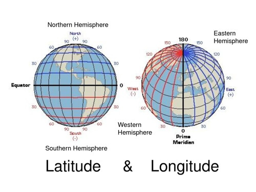
用于常见纬度和经度计算的轻量级库
一个用于将包版本提取到代码中的构建器。
用于 Dart 和 Flutter 的 HTTP 请求模拟库。在隔离环境中测试您的应用程序。
一种快速算法,用于查找多边形的不可达中心点,以 Dart 库的形式实现。对于在多边形上最优放置文本标签非常有用。
{"sdk":"flutter"}{"sdk":"flutter"}^8.1.1^2.0.0+1^2.0.1^2.1.5^14.0.2^0.9.0^2.1.4^1.0.1^3.1.0{"git":{"url":"https://github.com/OPENER-next/animated_location_indicator.git"}}{"git":{"url":"https://github.com/OPENER-next/animated_marker_layer.git"}}{"git":{"url":"https://github.com/OPENER-next/osm_api.git"}}{"git":{"url":"https://github.com/OPENER-next/temaki_flutter.git"}}{"git":{"url":"https://github.com/OPENER-next/offline_geocoder.git"}}^1.17.0^5.1.0^2.5.5^11.1.0^6.0.17^5.1.0^3.1.0+7447^1.0.5{"git":{"url":"https://github.com/Robbendebiene/flutter-mvvm-architecture.git","ref":"cdbfec0bec66614abfbd154850a735dd0b026888"}}^7.6.0^2.2.0^2.0.6+5^0.7.1^8.0.0any^2.13.1{"sdk":"flutter"}^0.14.1^6.0.0^1.2.1^1.11.0^2.6.0^2.1.1以下为英文项目原文快照,最新内容请访问 GitHub。
OpenStop
The goal of this app is to collect accessibility data for public transport stops in OpenStreetMap so that everyone can benefit from it. Due to the huge amount of public transport stops out there we want to encourage all citizen (experienced OSM users and newcomers) to help gathering this data. That's why we are developing this app that allows collecting the data in an easy, accessible and safe manner by asking simple questions. For deeper insight read the working principle of the app.
The data shall be the foundation for better routing especially for impaired people and lead to a renovation of non accessible stops, as well as many other things we ourselves can't even imagine right now.
Thanks and happy mapping!
Get it on Google Play Download on the App Store Get it on F-Droid
Screenshot with map overview Screenshot with visualized POI Screenshot with multiple choice question dialog Screenshot with bool question dialog and extended info box Screenshot with summary and upload dialog
We are always happy, if you not only want to help us mapping, but also want to directly participate in the project.
You can either open issues for enhancement suggestions and bug reports or help us developing the app further. A good starting point for the latter is to read the build instructions for the app.
You can also help translating the app at Weblate.
This app is released under the terms of the GNU General Public License v3.0 or later (GPL-3.0-or-later).
Logo of the German Federal Ministry of Digital Affairs and Transport Logo of the mFUND innovation initiative
OpenStop is developed in the project OPENER next, which is funded by the German Federal Ministry for Digital and Transport as part of the mFUND innovation initiative.
Special thanks to Andy Allan (@gravitystorm) for granting us free access to the beautiful Thunderforest map tiles.