
 v1.2.0
fluster
一个用于 Dart 的地理空间点聚类库,帮助在地图解决方案中提供标记之间的间距。
133喜欢 9300近 30 天下载150Pub 分数
AndroidiOSWebmacOSWindowsLinux
一个用于 Dart 的地理空间点聚类库。

以下为英文项目原文快照,最新内容请访问 GitHub。
Fluster = Flutter + Cluster
A geospatial point clustering library for Dart (Flutter not actually required). The algorithm is a Dart port of supercluster.
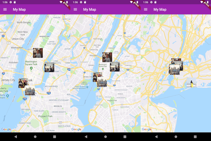
Image
Fluster will cluster a List of objects that conform to the Clusterable abstract class, which includes necessary information such as latitude and longitude:
class MapMarker extends Clusterable {
  String locationName;
  String thumbnailSrc;

  MapMarker(
      {this.locationName,
      latitude,
      longitude,
      this.thumbnailSrc,
      isCluster = false,
      clusterId,
      pointsSize,
      markerId,
      childMarkerId})
      : super(
            latitude: latitude,
            longitude: longitude,
            isCluster: isCluster,
            clusterId: clusterId,
            pointsSize: pointsSize,
            markerId: markerId,
            childMarkerId: childMarkerId);
}
Create a Fluster instance once you have a set of points you'd like to cluster:
List<MapMarker> markers = getMarkers();

Fluster<MapMarker> fluster = Fluster<MapMarker>(
      minZoom: 0,
      maxZoom: 20,
      radius: 150,
      extent: 2048,
      nodeSize: 64,
      points: markers,
      createCluster: (BaseCluster cluster, double longitude, double latitude) {
        return MapMarker(
            markerId: cluster.id.toString(),
            latitude: latitude,
            longitude: longitude);
      });
Parameters:
/// Any zoom value below minZoom will not generate clusters.
int minZoom;

/// Any zoom value above maxZoom will not generate clusters.
int maxZoom;

/// Cluster radius in pixels.
int radius;

/// Adjust the extent by powers of 2 (e.g. 512. 1024, ... max 8192) to get the
/// desired distance between markers where they start to cluster.
int extent;

/// The size of the KD-tree leaf node, which affects performance.
int nodeSize;

/// The List to be clustered.
List<T> points;

/// A callback to generate clusters of the given input type.
T Function(BaseCluster, double, double) createCluster;
You can then get the clusters for a given bounding box and zoom value, where the bounding box = [southwestLng, southwestLat, northeastLng, northeastLat]:
List<MapMarker> clusters = fluster.clusters([-180, -85, 180, 85], _currentZoom);
You can also get the children (points and sub-clusters inside a cluster at the next zoom level, given the cluster id:
List<MapMarker> chilren = fluster.children(int clusterId);
Get only the child points (not sub-clusters) of a cluster in all the remaining zoom levels, given the cluster id:
List<MapMarker> points = fluster.points(clusterId);