
 v2.0.3
map
फ्लटर के लिए भौगोलिक मानचित्र विजेट, जो विभिन्न प्रक्षेपण (EPSG4326/मर्केटर/WGS1984) का समर्थन करता है।
316लाइक 4 हज़ार30-दिन डाउनलोड160Pub अंक
AndroidiOSWebmacOSWindowsLinux
कंप्यूटर विजन का उपयोग करके ड्रोन का पता लगाएं, और उनकी स्थिति को एक मानचित्र पर चित्रित करें।
 v2.0.3
फ्लटर के लिए भौगोलिक मानचित्र विजेट, जो विभिन्न प्रक्षेपण (EPSG4326/मर्केटर/WGS1984) का समर्थन करता है।
प्रसिद्ध वेब आइकन फॉन्ट्स से फ्लटर आइकन। fluttericon.com का उपयोग करके अपने अंतिम आइकन पैकेज को कस्टमाइज़ करें।
यह अंग्रेज़ी मूल स्नैपशॉट है। नवीनतम सामग्री GitHub पर देखें।
Drone Detection Map is the Hunter Concept's Ground Sensor application.
It was built using Android Studio SDK, Flutter framework and supporting libraries.
Developed by myself, as well as vintageyj.
Drone Detection Map is designed to enable aerial surveillance of a deployment site through object detections on unauthorised (hostile) drones.
Features that Drone Detection Map offers:
Due to outdated TFLite plugins for Flutter, the computer vision aspect of Drone Detection Map had to be built on native Android. As such, the Map module of had to be attached as a Flutter module.
When developing on different workstations, the Flutter packages and dependencies needs to be updated. This can be done so by running the following command lines within the Flutter module's working directory:
flutter clean
followed by
flutter pub get
Drone Detection Map has mainly two feature-filled modules, the Map and Object Detector.
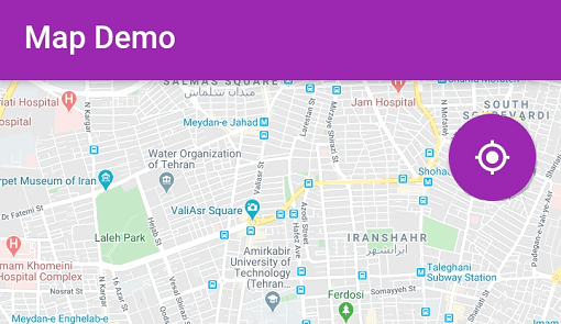
On application launch, it will first launch the map module, with orienation lock on. The screen will show the phone's current location and heading.
https://raw.githubusercontent.com/dionlahh/drone-detection-android-application/HEAD/android/readme%20album/map/Updated/appbar_buttons.jpg
These buttons allows for the user to draw its corresponding shapes/objects on the map:
https://raw.githubusercontent.com/dionlahh/drone-detection-android-application/HEAD/android/readme%20album/map/Polyline_Trim_AdobeExpress.gif
https://raw.githubusercontent.com/dionlahh/drone-detection-android-application/HEAD/android/readme%20album/map/Polygon_Trim_AdobeExpress.gif
https://raw.githubusercontent.com/dionlahh/drone-detection-android-application/HEAD/android/readme%20album/map/Marker_Trim_AdobeExpress.gif
https://raw.githubusercontent.com/dionlahh/drone-detection-android-application/HEAD/android/readme%20album/map/Circle_Trim_AdobeExpress.gif
The objection detection module is accessible by clicking on the Launch Camera Button.
https://raw.githubusercontent.com/dionlahh/drone-detection-android-application/HEAD/android/readme%20album/detector/detector_setup.gif https://raw.githubusercontent.com/dionlahh/drone-detection-android-application/HEAD/android/readme%20album/detector/od_setup.jpg
Drone Detection Map has a Red Line feature where it can establish a detection cutoff area on the screen. This prevents any unwanted detections below the Red Line, which can be useful in the future for the Hunter Concept's Interceptor drone. This feature can be toggled on or off in the settings page.
https://raw.githubusercontent.com/dionlahh/drone-detection-android-application/HEAD/android/readme%20album/detector/redline_demo.gif
The object detector module also comes equip with range and geopositioning capabilites.
https://raw.githubusercontent.com/dionlahh/drone-detection-android-application/HEAD/android/readme%20album/detector/drone_straightline_large.gif
The distance between the phone and the detected drone is estimated using the bounding box size of the drone relative to its actual size, as well as the Pinhole Camera Model, enabling the 2D screen coordinates to 3D world coordinates conversion.
The bounding box's screen coordinates returned by the inference machine is with respect to the input image size, so additional scaling steps has to be done to factor for the model's input image size and the screen's physical size.
Finally, using the derived distance, the phone's orientation, hearings, current position and the drone's relative heading, we can find the resulting latitude and longitude (LatLong) of the detected drone.
The resulting LatLong can then be saved during detections to be plotted on the map module.
https://raw.githubusercontent.com/dionlahh/drone-detection-android-application/HEAD/android/readme%20album/detector/drone_last_location.jpg https://raw.githubusercontent.com/dionlahh/drone-detection-android-application/HEAD/android/readme%20album/detector/drone_flight_path.jpg https://raw.githubusercontent.com/dionlahh/drone-detection-android-application/HEAD/android/readme%20album/detector/drone_flightpath_timelapse.gif
Clicking the Drone View Mode Toggle cycles through the different view for the detected drone's locations.
We used BLoC to implement the MVVM architecture for the map.
Two different BLoCs were used. One for the application to decide which set of buttons and sliders to render on the screen, and when should it be rendered, and the other was used for handling on screen taps.
We have four main models used, namely Circles, Polygons, Polylines, and Markers. Each of these models are then controlled by a view-model, ObjectMgr.
If the user plots a new circle on the map, the model
Circlesis first created using the View-Model, then the map renders theCircleMarkerbased on the attributes on the Circles model.
This section includes useful libraries and plugins used within the Ground Sensor project.
Flutter Dependencies:
Native Android Libraries: