
 v1.1.2
google_maps_routes
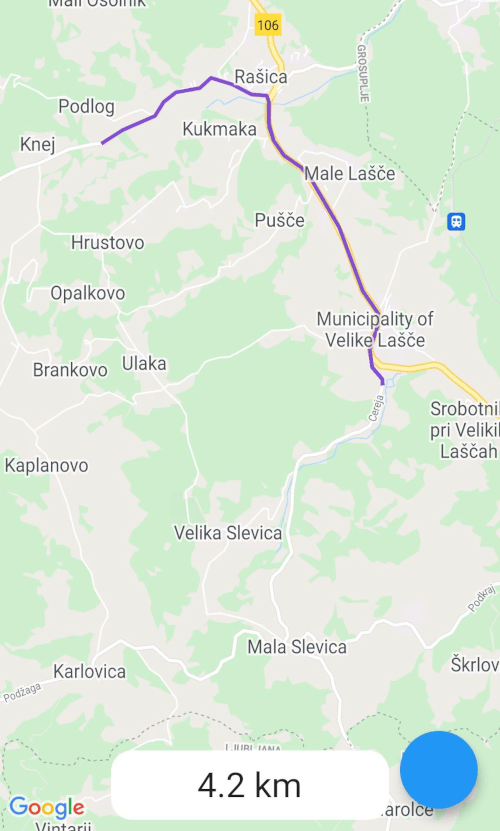
Google 지도 방향 API를 사용하여 Google 지도에 경로를 그리는 패키지입니다.
29좋아요 1.2천30일 다운로드140Pub 점수
AndroidiOSWeb
Google 지도 방향 API를 사용하여 Google 지도에 경로를 그리는 패키지입니다.

{"sdk":"flutter"}^1.0.0^2.0.3{"sdk":"flutter"}아래는 영문 원문 스냅샷입니다. 최신 내용은 GitHub에서 확인하세요.
This is a package for creating routes on google maps using the directions API from Google. Routes are drawn with help of the flutter_polyline_points package.
To use the google_maps_routes package, first depend on it.
Then import it where you want to use it
import 'package:google_maps_routes/google_maps_routes.dart';
To use it you need a List of points like this:
/// LatLng is included in google_maps_flutter
List<LatLng> points = [
    LatLng(latitude, longitude),
    LatLng(latitude, longitude),
    LatLng(latitude, longitude),
    LatLng(latitude, longitude),
];
Then you need to instantiate this plugin
MapsRoutes route = new MapsRoutes();
To create a route, just call the following function:
/// routeName is a string and can be anything; it can include spaces but
/// they will be replaced with a dash
/// example: 'Example route' turns into 'Example-route'

/// color is a Color type and will be used as the polyline color:
/// example: Color.fromRGBO(130, 78, 210, 1.0)

/// googleApyKey is a string and is a google directions API key
/// example: get it at
/// https://developers.google.com/maps/documentation/directions/get-api-key
await route.drawRoute(points, routeName, color, googleApiKey);
To use a different travel mode, use the travelMode parameter.
/// Options: driving, bicycling, transit, walking
await route.drawRoute(
    points,
    routeName,
    color,
    googleApiKey,
    travelMode: TravelModes.walking
);
To display the polylines you need to add a polylines parameter to your google map widget.
GoogleMap(polylines: route.routes),
If you ever want to clear the routes, just call:
route.routes.clear();
If you want to calculate the distance of the route use you call the following function with the same List of points you used for drawing the route. You can also use it by itself.
/// Initialize a calculator
DistanceCalculator distanceCalculator = new DistanceCalculator();

/// Call a function that returns a string
/// Pass it the List of points
/// By default it will return with 1 decimal point but you can pass an
/// option that changes that
distanceCalculator.calculateRouteDistance(points, decimals: 1);