搜尋套件、儲存庫與 APP 分類

google_maps_cluster_manager 封面
套件詳情v3.1.0

google_maps_cluster_manager

基於 Geohash 的簡單 Flutter 聚合庫,用於 Google 地圖。

近 30 天下載
3020
喜歡數
311
Pub 分數
90

安裝套件

flutter pub add google_maps_cluster_manager

套件介紹

根據套件公開資料產生的選型評估,僅供參考。

一個簡單的 Flutter 聚類庫,用於 Google 地圖,使用 Geohash 高效地將附近的標記分組。它透過將多個點合併為聚類來減少地圖雜亂,進而提升顯示大量位置時的效能與使用者體驗。該庫與 Google Maps for Flutter 無縫整合,提供可自訂的聚類圖示與流暢動畫。非常適合需要在密集標記集上保持視覺清晰度的應用程式。

適用情境

  • 在地圖上顯示大型數據集
  • 透過大量標記改善地圖效能
  • 提升基於位置的應用程式之使用者體驗
  • 可視化地理空間資料群集
  • 創建互動式地圖介面

主要特色

  • 基於GeoHash的聚類
  • 可自訂的群集圖示
  • 流暢的動畫過渡
  • 與 Google 地圖輕鬆整合
  • 支援動態標記更新

適合對象

  • 具有高密度位置資料的應用程式
  • 地圖密集型應用
  • 尋求輕量級聚類的開發者
  • 使用 Google Maps 的 Flutter 項目
  • 需要高效標記管理的使用者

使用建議

  • 需要 Google Maps for Flutter 設定
  • 僅限 Google 地圖平台
  • 聚類邏輯可能需要針對特定使用案例進行調整
  • 不支援非 geohash 方法的內建支援
  • 依賴外部倉庫進行更新

原始 README

以下為關聯原始碼儲存庫的 README 原文快照,最新內容請造訪原始碼儲存庫。

pub package

Flutter Cluster Manager for Google Maps

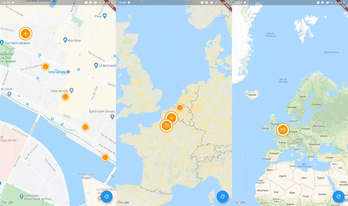
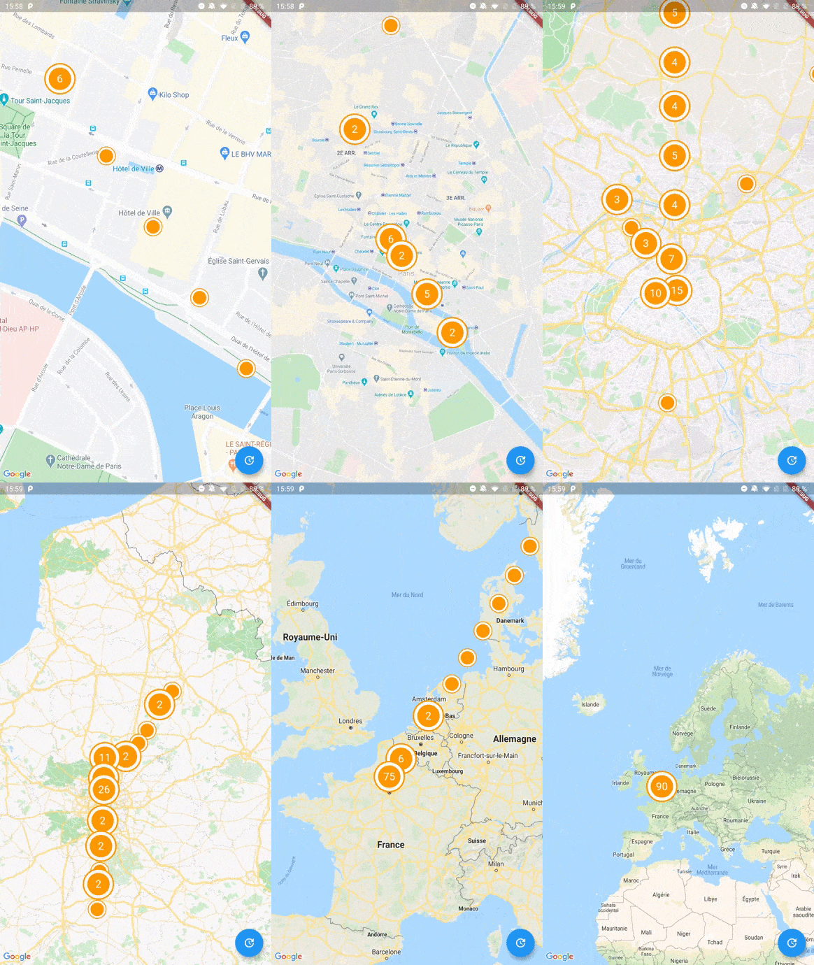
Screenshot

A Flutter package to cluster items on a Google Maps widget based on Geohash. Highly inspired by clustering_google_maps

Usage

To use this package, add google_maps_cluster_manager as a dependency in your pubspec.yaml file.

Getting Started

Your map items has to use ClusterItem as a mixin (or extends this class) and implements the LatLng location getter.

class Place with ClusterItem {
  final String name;
  final LatLng latLng;

  Place({required this.name, required this.latLng});

  @override
  LatLng get location => latLng;
}

To start with Cluster Manager, you have to initialize a ClusterManager instance.

ClusterManager<Place>(
    _items, // Your items to be clustered on the map (of Place type for this example)
    _updateMarkers, // Method to be called when markers are updated
    markerBuilder: _markerBuilder, // Optional : Method to implement if you want to customize markers
    levels: [1, 4.25, 6.75, 8.25, 11.5, 14.5, 16.0, 16.5, 20.0], // Optional : Configure this if you want to change zoom levels at which the clustering precision change
    extraPercent: 0.2, // Optional : This number represents the percentage (0.2 for 20%) of latitude and longitude (in each direction) to be considered on top of the visible map bounds to render clusters. This way, clusters don't "pop out" when you cross the map.
    stopClusteringZoom: 17.0 // Optional : The zoom level to stop clustering, so it's only rendering single item "clusters"
);

When your GoogleMapController is created, you have to set the mapId with the setMapId method :

_manager.setMapId(controller.mapId);

You are able to add an new item to the map by calling addItem method on your ClusterManager instance. You can also completely change the items on your maps by calling setItems method.

You can customize the icon of a cluster by using Future<Marker> Function(Cluster<T extends ClusterItem>) markerBuilder parameter.

static Future<Marker> Function(Cluster) get markerBuilder => (cluster) async {
  return Marker(
    markerId: MarkerId(cluster.getId()),
    position: cluster.location,
    onTap: () {
        print(cluster.items);
    },
    icon: await getClusterBitmap(cluster.isMultiple ? 125 : 75,
    text: cluster.isMultiple? cluster.count.toString() : null),
  );
};

static Future<BitmapDescriptor> getClusterBitmap(int size, {String text?}) async {
  final PictureRecorder pictureRecorder = PictureRecorder();
  final Canvas canvas = Canvas(pictureRecorder);
  final Paint paint1 = Paint()..color = Colors.red;

  canvas.drawCircle(Offset(size / 2, size / 2), size / 2.0, paint1);

  if (text != null) {
    TextPainter painter = TextPainter(textDirection: TextDirection.ltr);
    painter.text = TextSpan(
    text: text,
    style: TextStyle(
        fontSize: size / 3,
        color: Colors.white,
        fontWeight: FontWeight.normal),
    );
    painter.layout();
    painter.paint(
      canvas,
      Offset(size / 2 - painter.width / 2, size / 2 - painter.height / 2),
    );
  }

  final img = await pictureRecorder.endRecording().toImage(size, size);
  final data = await img.toByteData(format: ImageByteFormat.png);

  return BitmapDescriptor.fromBytes(data.buffer.asUint8List());
}

Every cluster (even one item clusters) is rendered by the library as a Cluster<T extends ClusterItem> object. You can differentiate single item clusters from multiple ones by using the isMultiple variable (or the count variable). This way, you can create different markers icon depending on the type of cluster.

You can create multiple managers for a single map, see the multiple.dart example.

Complete Basic Example

See the example directory for a complete sample app.

所屬分類

依賴

依賴清單 1 項

  • google_maps_flutter_platform_interface^2.4.3

原始碼儲存庫

使用此套件的專案