Orientação gerada a partir de informações públicas. Apenas para referência.
geojson_vi é uma biblioteca de código aberto em Dart e Flutter projetada para processar dados GeoJSON com eficiência, em estrita conformidade com o RFC 7946. Permite aos desenvolvedores analisar, validar e manipular estruturas GeoJSON, como pontos, linhas, polígonos e coleções de recursos, em aplicativos Flutter em múltiplas plataformas. A biblioteca oferece integração sem problemas em aplicativos Android, iOS, Web, macOS, Windows e Linux, tornando-a ideal para serviços baseados em localização e funcionalidades de mapeamento. Com foco em desempenho e correção, o geojson_vi simplifica o trabalho com dados geográficos em projetos Flutter modernos.
Casos de uso
Aplicações baseadas em mapas
visualização de dados geoespaciais
Recursos com conhecimento de localização
Validação de dados para fluxos de trabalho do GIS
Integração com APIs de mapeamento
Principais recursos
Compatível com o RFC 7946
Suporte multiplataforma
Análise e serialização eficientes
Suporte a todos os tipos GeoJSON
Leve e fácil de integrar
Indicado para
Desenvolvedores Flutter trabalhando com mapas
manipulação de dados de GIS em aplicativos móveis
Aplicações que exigem processamento preciso de GeoJSON
Projetos que precisam de ferramentas de geodados independentes de plataforma
Desenvolvedores procurando soluções de GeoJSON de código aberto
Considerações
Requer entendimento da estrutura do GeoJSON
Limitado a operações específicas do GeoJSON
Nenhuma renderização de mapa embutida
Depende de bibliotecas externas de mapeamento para exibição
Não otimizado para análise espacial em grande escala
README original
Snapshot do README original do repositório-fonte vinculado. Consulte o repositório para o conteúdo mais recente.
geojson_vi: An Open-Source Dart and Flutter Library for Efficiently Handling GeoJSON Data in Compliance with RFC 7946
geojson_vi is an open-source library for Dart and Flutter developers, specifically designed to provide comprehensive support for the GeoJSON geospatial data interchange format as per the RFC 7946 standard. The software is a flexible, reliable tool that allows developers to parse, read, create, update, search, and delete geospatial data effectively.
Feature Highlights of geojson_vi
Powerful Tools for Efficient GeoJSON Data Handling. Some of the primary ones include:
Parsing and Reading GeoJSON Data: geojson_vi allows developers to quickly parse and read GeoJSON data, ensuring full compliance with RFC 7946 standard.
Creating, Updating, Searching, and Deleting GeoJSON Data: With geojson_vi, developers can easily manipulate GeoJSON data, from creating new data entries to updating, searching, and deleting existing data.
Support for All GeoJSON Objects: geojson_vi offers comprehensive support for a wide range of Geometry types (GeoJSONPoint, GeoJSONMultiPoint, GeoJSONLineString, GeoJSONMultiLineString, GeoJSONPolygon, GeoJSONMultiPolygon, GeoJSONGeometryCollection), Feature, and FeatureCollection, making it a versatile tool for effectively managing diverse geospatial data.
GeoJSON UML Model
Class structure of the geojson_vi library
Detailed Class Diagram of GeoJSON Geometry in the geojson_vi library
Usage
Create GeoJSON object
final map = {
'type': 'Point',
'coordinates': [105.77389, 21.0720414]
};
final jsonString =
'{"type": "Point", "coordinates": [105.78070163726807, 21.067921688241626]}';
final polygonCoordinates = [
[
[104.765625, 20.468189],
[106.545410, 20.468189],
[106.545410, 21.596150],
[104.765625, 21.596150],
[104.765625, 20.468189]
]
];
// Creating a GeoJSON object from data without knowing its typefinal pointFromMap = GeoJSON.fromMap(map);
// Creating a GeoJSONPoint object from a JSON string when the type is knownfinal pointFromJSON = GeoJSONPoint.fromJSON(jsonString);
// Creating a GeoJSONGeometry object from data without knowing its typefinal geometryFromMap = GeoJSONGeometry.fromMap(map);
// Creating a GeoJSONPoint object from a JSON string when the type is knownfinal geometryFromJSON = GeoJSONPoint.fromJSON(jsonString);
// Creating a GeoJSONPoint object from coordinates datafinal pointFromCoordinates = GeoJSONPoint([105.77389, 21.0720414]);
// Creating a GeoJSONFeature objectfinal feature = GeoJSONFeature(
GeoJSONPoint([105.780701, 21.067921]),
properties: {
'title': 'Hanoi University of Mining and Geology',
'url': 'http://humg.edu.vn',
},
);
// Creating a GeoJSONFeatureCollection objectfinal featureCollection = GeoJSONFeatureCollection([]);
featureCollection.features.add(feature);
// Creating more GeoJSONFeaturefinal polygon = GeoJSONPolygon(polygonCoordinates);
final polygonFeature = GeoJSONFeature(polygon);
featureCollection.features.add(polygonFeature);
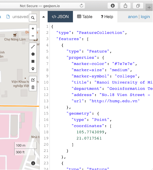
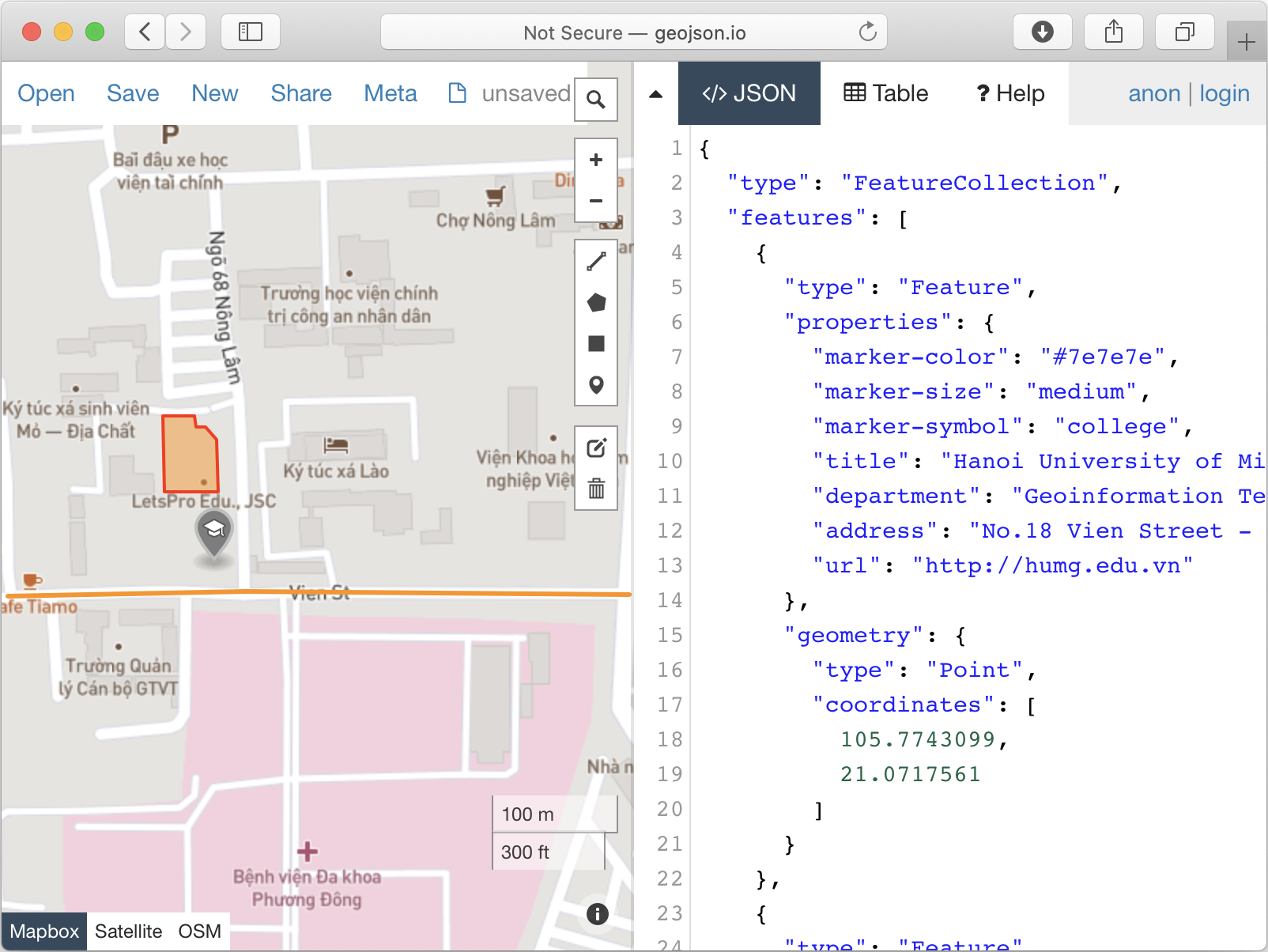
Demo
import'package:geojson_vi/geojson_vi.dart';
voidmain() {
final featureCollection = GeoJSONFeatureCollection([]);
final point = GeoJSONPoint([105.7743099, 21.0717561]);
final feature = GeoJSONFeature(point, properties: {
'marker-color': '#7e7e7e',
'marker-size': 'medium',
'marker-symbol': 'college',
'title': 'Hanoi University of Mining and Geology',
'department': 'Geoinformation Technology',
'address':
'No.18 Vien Street - Duc Thang Ward - Bac Tu Liem District - Ha Noi, Vietnam',
'url': 'http://humg.edu.vn'
});
featureCollection.features.add(feature);
final pos1 = [105.7771289, 21.0715458];
final pos2 = [105.7745218, 21.0715658];
final pos3 = [105.7729125, 21.0715358];
final lineString = GeoJSONLineString([pos1, pos2, pos3]);
featureCollection.features.add(GeoJSONFeature(lineString, properties: {
'stroke': '#7e7e7e',
'stroke-width': 2,
'stroke-opacity': 1,
'title': 'Vien St.'
}));
final p01 = [105.7739666, 21.0726795]; // The first positionfinal p02 = [105.7739719, 21.0721991];
final p03 = [105.7743394, 21.0721966];
final p04 = [105.7743310, 21.0725269];
final p05 = [105.7742564, 21.0726120];
final p06 = [105.7741865, 21.0726095];
final p07 = [105.7741785, 21.0726746];
final p08 = [105.7739666, 21.0726795]; // The last positionfinal linerRing = [p01, p02, p03, p04, p05, p06, p07, p08];
featureCollection.features.add(
GeoJSONFeature(
GeoJSONPolygon([linerRing]),
properties: {
'stroke': '#555555',
'stroke-width': 2,
'stroke-opacity': 1,
'fill': '#ab7942',
'fill-opacity': 0.5,
'title': "HUMG's Office"
},
),
);
print(featureCollection.toJSON());
}