open_route_service 패키지는 Dart 및 Flutter용으로 OpenRouteService API에 대한 사용자 친화적인 래퍼를 제공하여 개발자가 애플리케이션에 경로 계획 및 지리공간 데이터를 쉽게 통합할 수 있도록 합니다. 깔끔하고 직관적인 메서드를 통해 경로 계산, 안내 정보 조회, 맵 관련 정보 접근 등의 작업을 간소화합니다. 단계별 내비게이션 또는 여행 거리 계산이 필요한 위치 기반 앱에 적합하며, 모바일, 웹, 데스크톱 등 다양한 플랫폼을 지원합니다. 이 패키지는 가볍고 잘 문서화되어 있어 초보자와 숙련된 개발자 모두에게 접근하기 쉬우며 사용하기 편리합니다.
사용 사례
여행 앱에서의 경로 계획
턴바이턴 안내를 제공하는 내비게이션
거리 및 소요 시간 계산
지도 기반 물류 추적
지리공간 데이터 검색
다중 플랫폼 위치 서비스
주요 기능
간단한 API 통합
다중 플랫폼 지원
실시간 경로 생성
JSON 응답 파싱
내장 오류 처리
크로스 플랫폼 호환성
적합한 대상
Flutter 개발자가 탐색 기능을 구축하고 있습니다
경로 최적화가 필요한 앱
OpenRouteService API를 사용하는 프로젝트
경량 지오로케이션 도구를 찾는 개발자
크로스플랫폼 모바일 및 웹 앱
고려 사항
OpenRouteService에서 API 키가 필요합니다
인터넷 연결에 따라 다름
OpenRouteService의 사용 가능한 엔드포인트에 제한됨
복잡한 응답을 처리하기 위해 추가 파싱이 필요할 수 있습니다
구독 등급에 따라 속도 제한이 적용됩니다
원본 README
연결된 소스 저장소의 README 원문 스냅샷입니다. 최신 내용은 저장소에서 확인하세요.
open_route_service
A Dart and Flutter client for openrouteservice directions, isochrones, matrices, geocoding, points of interest, elevation, and route optimization.
The package provides typed request and response models around the openrouteservice API for Dart and Flutter projects.
The goal is to develop an all-encompassing package that can encapsulate everything openrouteservice API offers.
With all of their internal Optimizations, this includes:
Directions:
Route Generation between any two or more coordinates for any mode of transportation. For example, from a starting point to a destination on 'foot-walking'.
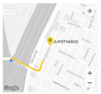
E.g. ORSDirections.directionsRouteCoordsGet gives a List of ORSCoordinate which can then be easily used to draw a Polyline route on a map in a Flutter Application or anything else you can think of.
Route Drawn on Flutter App Map using Coordinates
Elevation:
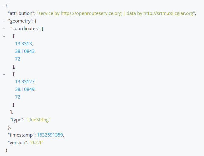
Get the elevation of a coordinate, or a list of coordinates. Fetches the ElevationData by taking a 2D ORSCoordinate or planar line geometry, and enriching it with elevation from a variety of datasets.
Elevation Response Received
Isochrones:
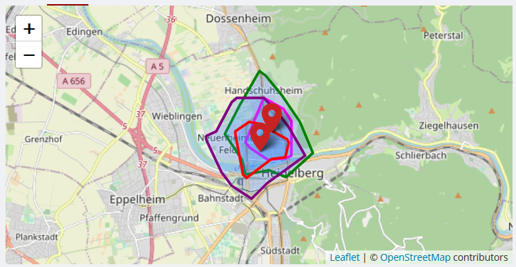
Obtain Isochrone (areas of reachability) Data for the locations given. The isochrone is a polygon that encloses a given point and is bounded by a given time.
The isochrone data can be used to draw them on a map in a Flutter Application, or anything else you can think of.
Isochrone Drawn on Map
Time-Distance Matrix:
Obtain one-to-many, many-to-one and many-to-many matrices for time and distance. Returns duration or distance matrix for multiple source and destination points.
Pelias Geocoding:
Resolve input coordinates to addresses and vice versa. Provides functionality for geocoding autocomplete queries, search queries, and reverse geocoding.
Reverse Geocoding Information used on Map
POIs:
Obtains information about the Points of Interest (POIs) in the area surrounding a geometry which can either be a bounding box, polygon or buffered linestring, or point.
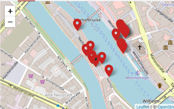
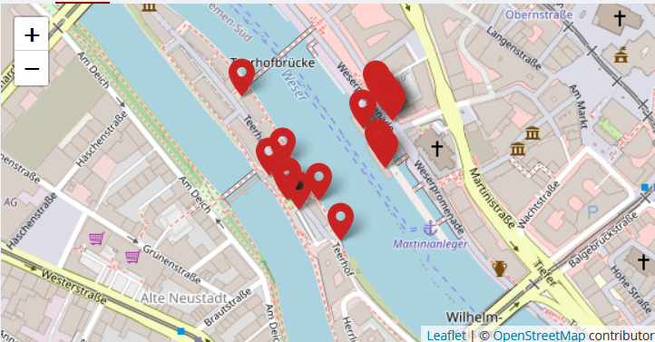
The Points of Interest can be marked on a map in a Flutter Application, or their properties and information visualized in various ways, or anything else you can think of.
Points of Interest Drawn on Map
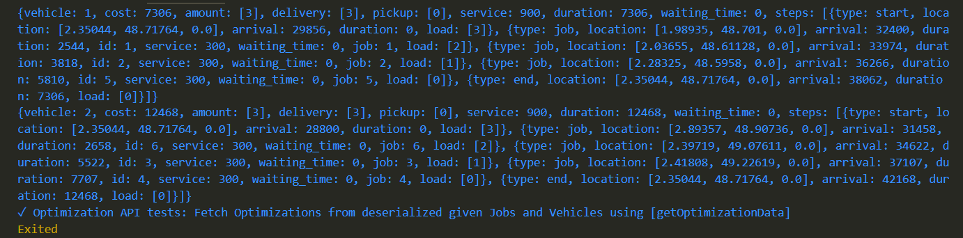
Routing Optimizations:
The optimization endpoint solves Vehicle Routing Problems and can be used to schedule multiple vehicles and jobs, respecting time windows, capacities and required skills.
Use the handy class methods to easily generate Directions, Isochrones, Time-Distance Matrix, Pelias Geocoding, POIs, Elevation and routing Optimizations etc, letting the package handle all the complex HTTP requests in the background for you.
Example Usage
To use the package with the Directions API to generate and draw a Route on a map in a Flutter application:
import'package:open_route_service/open_route_service.dart';
Future<void> main() async {
// Initialize the openrouteservice with your API key.finalOpenRouteService client = OpenRouteService(apiKey: 'YOUR-API-KEY');
// Example coordinates to test betweenconstdouble startLat = 37.4220698;
constdouble startLng = -122.0862784;
constdouble endLat = 37.4111466;
constdouble endLng = -122.0792365;
// Form Route between coordinatesfinalList<ORSCoordinate> routeCoordinates = await client.directionsRouteCoordsGet(
startCoordinate: ORSCoordinate(latitude: startLat, longitude: startLng),
endCoordinate: ORSCoordinate(latitude: endLat, longitude: endLng),
);
// Print the route coordinates
routeCoordinates.forEach(print);
// Map route coordinates to a list of LatLng (requires google_maps_flutter package)// to be used in the Map route Polyline.finalList<LatLng> routePoints = routeCoordinates
.map((coordinate) => LatLng(coordinate.latitude, coordinate.longitude))
.toList();
// Create Polyline (requires Material UI for Color)finalPolyline routePolyline = Polyline(
polylineId: PolylineId('route'),
visible: true,
points: routePoints,
color: Colors.red,
width: 4,
);
// Use Polyline to draw route on map or do anything else with the data :)
}
Security
Report vulnerabilities privately by following SECURITY.md. Do not include API keys or other credentials in issues, examples, or pull requests.
Contribution Guidelines
See CONTRIBUTING.md for the development workflow and test requirements. Use GitHub issues for reproducible bugs and focused feature requests.
Dependencies
Dart or Flutter, for the Dart SDK which this obviously runs on.
http, for internally making RESTful HTTP Network requests to the API endpoints.