Turf는 turf.js를 영감으로 받아 Dart용 지오스페이셜 분석 라이브러리로, GeoJSON 데이터와 함께 작동하도록 설계되었습니다. 거리 계산, 버퍼링, 교차 등 공간 연산을 수행할 수 있는 도구 세트를 제공하며, 모든 기능은 순수 Dart로 구현됩니다. 네이티브 플랫폼 코드에 의존하지 않고 실시간 지리 계산이 필요한 애플리케이션에 적합합니다. Android, iOS, Web, macOS, Windows, Linux 등 여러 플랫폼을 지원하여 크로스플랫폼 개발에 매우 유연합니다. 가벼운 성능과 Flutter와의 호환성 덕분에 지도 및 위치 기반 기능에 적합합니다.
사용 사례
지리공간 데이터 처리
지도 기반 분석
위치 인식 애플리케이션
실시간 공간 계산
GeoJSON 조작
주요 기능
순수 Dart 구현
GeoJSON 지원
크로스 플랫폼 호환성
Turf.js와 유사한 API
광범위한 공간 연산
적합한 대상
Flutter 개발자
GIS 애플리케이션
모바일 및 웹 매핑
위치 데이터를 다루는 데이터 과학자
오프라인 지리공간 로직이 필요한 애플리케이션
고려 사항
GeoJSON 입력 형식이 필요합니다
기본 지리공간 기능에 한정
내장된 지도 렌더링 없음
성능은 데이터 크기에 따라 달라집니다
매우 큰 데이터 세트에 최적화되지 않음
원본 README
연결된 소스 저장소의 README 원문 스냅샷입니다. 최신 내용은 저장소에서 확인하세요.
A TurfJs-like geospatial analysis library written in pure Dart.
TurfDart is a Dart library for spatial analysis. It includes traditional spatial operations, helper functions for creating GeoJSON data, and data classification and statistics tools. You can use TurfDart in your Flutter applications on the web, mobile and desktop or in pure Dart applications running on the server.
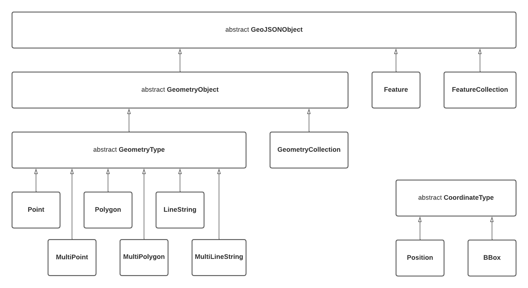
As the foundation, we are using Geotypes, a lightweight dart library that provides a strong GeoJSON object model and fully RFC 7946 compliant serializers.
Most of the functionality is a translation from turf.js, the progress can be found here.
Nested GeometryCollections (as described in
RFC 7946 section 3.1.8)
are not supported which takes a slightly firmer stance than the "should
avoid" language in the specification
Tests and Benchmarks
Tests are run with dart test and benchmarks can be run with
dart run benchmark
Any new benchmarks must be named *_benchmark.dart and reside in the
./benchmark folder.