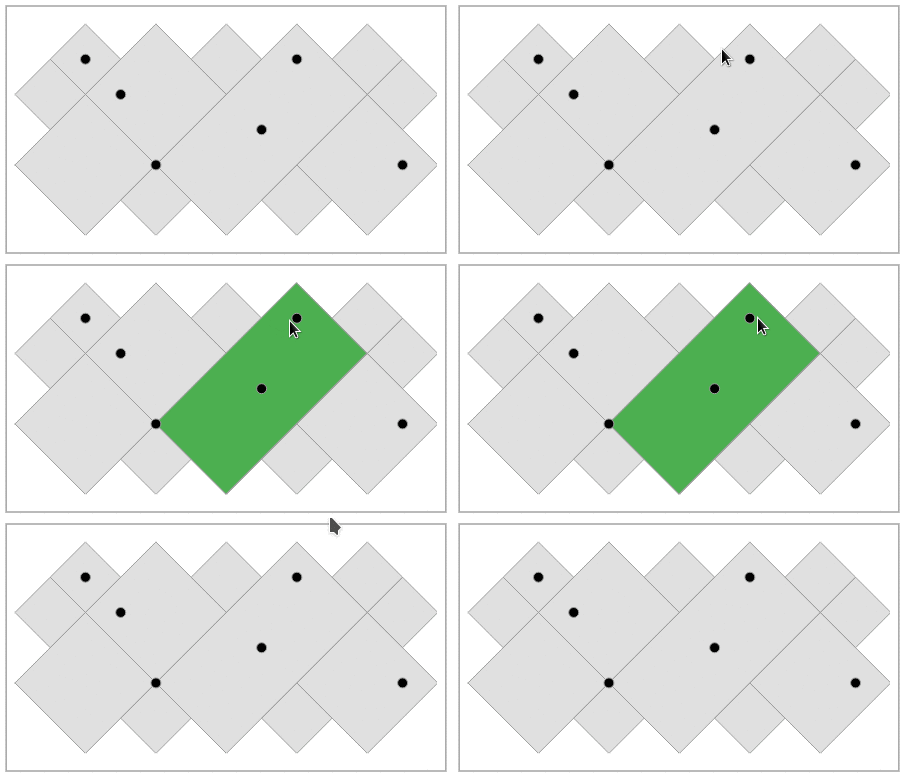
연결된 소스 저장소의 README 원문 스냅샷입니다. 최신 내용은 저장소에서 확인하세요.
Vector Map
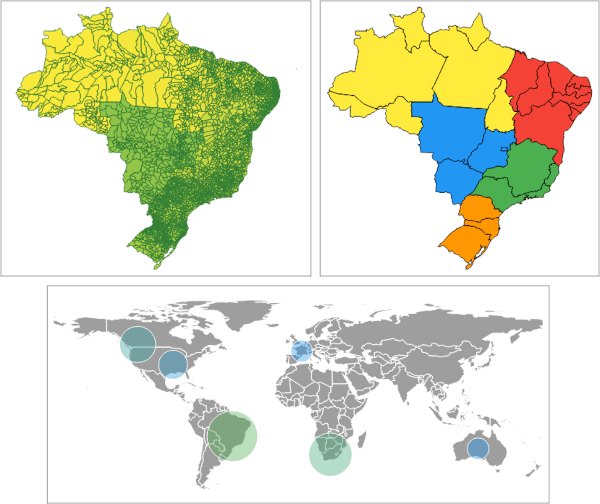
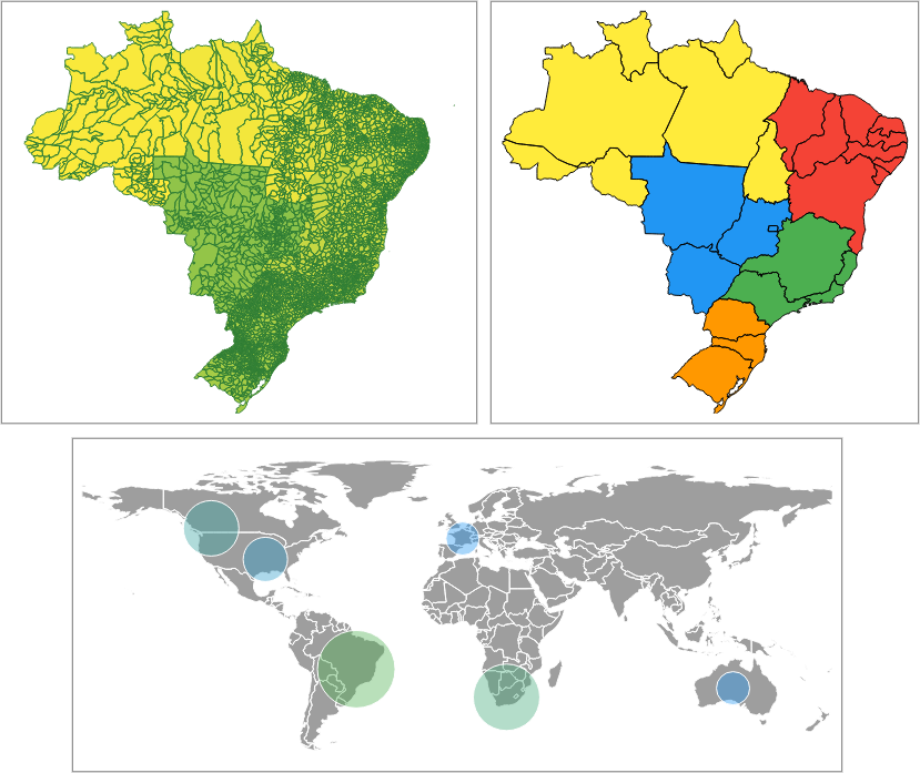
Compatible with GeoJSON
Multi resolution with geometry simplification
Highly customizable
High performance
Interactable
Pure Flutter (no WebView/JavaScript)
Usage
About the examples
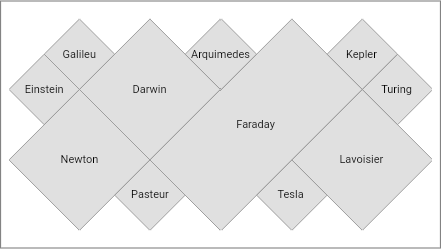
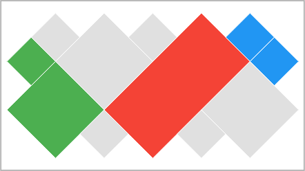
Simplified GeoJSONs will be used in the examples to demonstrate package usage.
The following examples will assume that GeoJSONs have already been loaded into Strings.
The full code is at https://github.com/caduandrade/vector_map_flutter_demo.
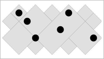
polygons.json (link )
Name
Seq
Rnd
Gts
"Einstein"
1
"73"
15000
"Newton"
2
"92"
7500
"Galileu"
3
"10"
3000
"Darwin"
4
15000
"Pasteur"
5
"77"
17000
"Faraday"
6
"32"
17500
"Arquimedes"
7
"87"
25000
"Tesla"
8
"17"
12500
"Lavoisier"
9
4000
"Kepler"
10
"32"
18000
"Turing"
11
"93"
31400
points.json (link )
Name
AN
"Titanium"
22
"Niobium"
41
"Carbon"
6
"Neon"
10
"Silicon"
14
"Hydrogen"
1
Reading GeoJSON from String
Reading the geometries only.
MapDataSource polygons = await MapDataSource .geoJson (geoJson: geoJson);
Reading GeoJSON properties
The keys argument defines which properties must be loaded.
The parseToNumber argument defines which properties will have numeric values in quotes parsed to numbers.
The labelKey defines which property will be used to display its values as feature labels.
MapDataSource polygons = await MapDataSource .geoJson (
geoJson: geoJson,
keys: ['Seq' , 'Rnd' ],
parseToNumber: ['Rnd' ],
labelKey: 'Rnd' );
Creating the Widget
VectorMapController _controller = VectorMapController ();
MapDataSource polygons = await MapDataSource .geoJson (geoJson: geoJson);
MapLayer layer = MapLayer (dataSource: polygons);
_controller.addLayer (layer);
VectorMap map = VectorMap (controller: _controller);
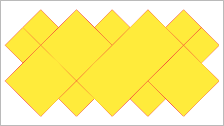
Theme
MapLayer layer = MapLayer (
dataSource: polygons,
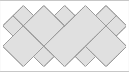
theme: MapTheme (color: Colors .yellow, contourColor: Colors .red));
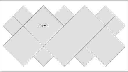
Label visibility
MapDataSource polygons =
await MapDataSource .geoJson (geoJson: geoJson, labelKey: 'Name' );
MapLayer layer = MapLayer (
dataSource: polygons,
theme: MapTheme (labelVisibility: (feature) => true ));
MapLayer layer = MapLayer (
dataSource: polygons,
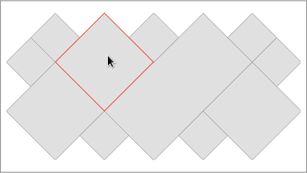
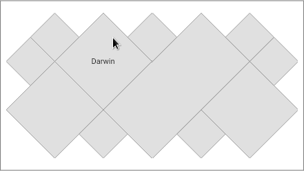
theme: MapTheme (labelVisibility: (feature) => feature.label == 'Darwin' ));
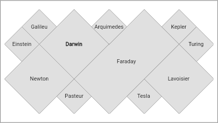
Label style
MapLayer layer = MapLayer (
dataSource: polygons,
theme: MapTheme (
labelVisibility: (feature) => true ,
labelStyleBuilder: (feature, featureColor, labelColor) {
if (feature.label == 'Darwin' ) {
return TextStyle (
color: labelColor,
fontWeight: FontWeight .bold,
fontSize: 11 ,
);
}
return TextStyle (
color: labelColor,
fontSize: 11 ,
);
}));
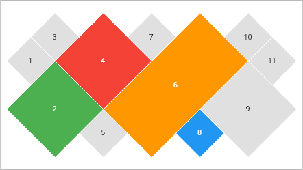
Color by property value
Sets a color for each property value in GeoJSON. If a color is not set, the default color is used.
Mapping the property key:
MapDataSource polygons = await MapDataSource .geoJson (
geoJson: geoJson, keys: ['Seq' ], labelKey: 'Seq' );
Setting the colors for the property values:
MapLayer layer = MapLayer (
dataSource: polygons,
theme: MapValueTheme (
contourColor: Colors .white,
labelVisibility: (feature) => true ,
key: 'Seq' ,
colors: {
2 : Colors .green,
4 : Colors .red,
6 : Colors .orange,
8 : Colors .blue
}));
Color by rule
The feature color is obtained from the first rule that returns a non-null color. If all rules return a null color, the default color is used.
Mapping the property key:
MapDataSource polygons =
await MapDataSource .geoJson (geoJson: geoJson, keys: ['Name' , 'Seq' ]);
Setting the rules:
MapLayer layer = MapLayer (
dataSource: polygons,
theme: MapRuleTheme (contourColor: Colors .white, colorRules: [
(feature) {
String ? value = feature.getValue ('Name' );
return value == 'Faraday' ? Colors .red : null ;
},
(feature) {
double? value = feature.getDoubleValue ('Seq' );
return value != null && value < 3 ? Colors .green : null ;
},
(feature) {
double? value = feature.getDoubleValue ('Seq' );
return value != null && value > 9 ? Colors .blue : null ;
}
]));
Gradient
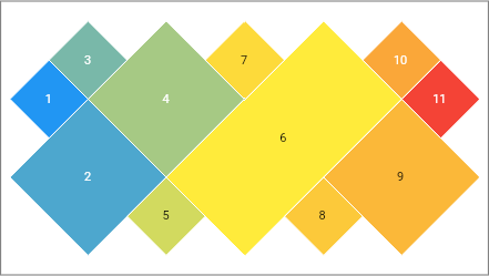
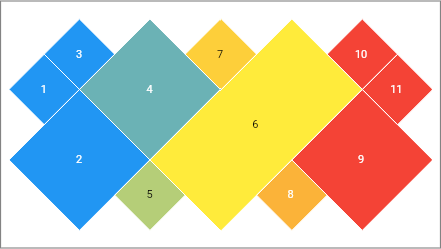
The gradient is created given the colors and limit values of the chosen property.
The property must have numeric values.
Auto min/max values
Uses the min and max values read from data source.
MapDataSource polygons = await MapDataSource .geoJson (
geoJson: geoJson, keys: ['Seq' ], labelKey: 'Seq' );
MapLayer layer = MapLayer (
dataSource: polygons,
theme: MapGradientTheme (
contourColor: Colors .white,
labelVisibility: (feature) => true ,
key: 'Seq' ,
colors: [Colors .blue, Colors .yellow, Colors .red]));
Setting min or max values manually
If the min value is set, all lower values will be displayed using the first gradient color.
If the max value is set, all higher values will be displayed using the last gradient color.
MapDataSource polygons = await MapDataSource .geoJson (
geoJson: geoJson, keys: ['Seq' ], labelKey: 'Seq' );
MapLayer layer = MapLayer (
dataSource: polygons,
theme: MapGradientTheme (
contourColor: Colors .white,
labelVisibility: (feature) => true ,
key: 'Seq' ,
min: 3 ,
max: 9 ,
colors: [Colors .blue, Colors .yellow, Colors .red]));
Highlight theme
Used by addons and cursor hover to highlight layer features on the map.
Color
MapLayer layer = MapLayer (
dataSource: polygons,
highlightTheme: MapHighlightTheme (color: Colors .green));
Contour color
MapLayer layer = MapLayer (
dataSource: polygons,
highlightTheme: MapHighlightTheme (contourColor: Colors .red));
Label
MapDataSource polygons =
await MapDataSource .geoJson (geoJson: geoJson, labelKey: 'Name' );
MapLayer layer = MapLayer (
dataSource: polygons,
highlightTheme: MapHighlightTheme (labelVisibility: (feature) => true ));
Contour thickness
VectorMapController _controller = VectorMapController (contourThickness: 3 );
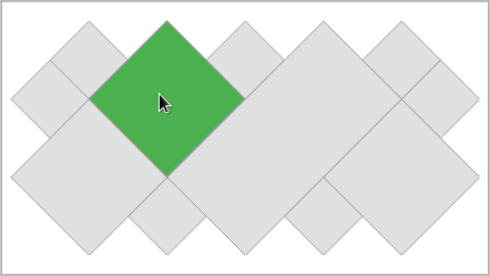
Cursor hover rule
Enabling hover by property value
MapDataSource polygons =
await MapDataSource .geoJson (geoJson: geoJson, keys: ['Seq' ]);
MapLayer layer = MapLayer (
dataSource: polygons,
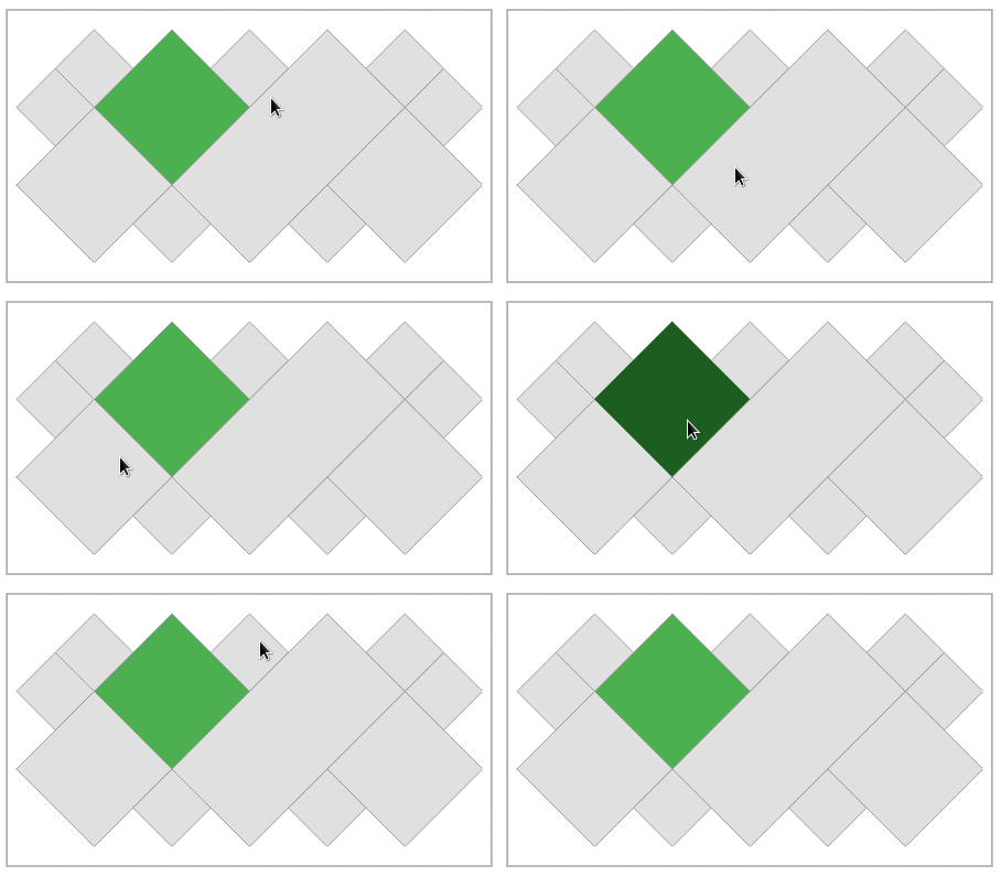
theme: MapValueTheme (key: 'Seq' , colors: {4 : Colors .green}),
highlightTheme: MapHighlightTheme (color: Colors .green[900 ]!));
VectorMap map = VectorMap (
controller: _controller,
hoverRule: (feature) {
return feature.getValue ('Seq' ) == 4 ;
});
Cursor hover listener
VectorMap map = VectorMap (
controller: _controller,
hoverListener: (MapFeature ? feature) {
if (feature != null ) {
int id = feature.id;
}
});
Layers
MapHighlightTheme highlightTheme = MapHighlightTheme (color: Colors .green);
MapDataSource polygons =
await MapDataSource .geoJson (geoJson: polygonsGeoJson);
MapLayer polygonLayer =
MapLayer (dataSource: polygons, highlightTheme: highlightTheme);
_controller.addLayer (polygonLayer);
MapDataSource points = await MapDataSource .geoJson (geoJson: pointsGeoJson);
MapLayer pointsLayer = MapLayer (
dataSource: points,
theme: MapTheme (color: Colors .black),
highlightTheme: highlightTheme);
_controller.addLayer (pointsLayer);
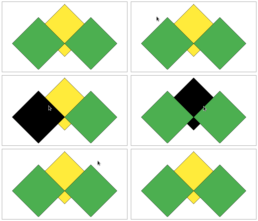
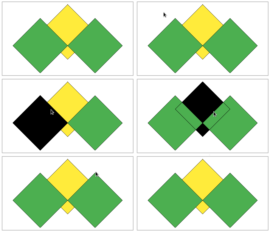
Overlay hover contour
Allows you to draw the contour over all layers
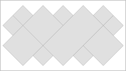
MapDataSource dataSource1 = MapDataSource .geometries ([
MapPolygon .coordinates ([2 , 3 , 4 , 5 , 6 , 3 , 4 , 1 , 2 , 3 ])
]);
MapDataSource dataSource2 = MapDataSource .geometries ([
MapPolygon .coordinates ([0 , 2 , 2 , 4 , 4 , 2 , 2 , 0 , 0 , 2 ]),
MapPolygon .coordinates ([4 , 2 , 6 , 4 , 8 , 2 , 6 , 0 , 4 , 2 ])
]);
Overlay disabled:
MapHighlightTheme highlightTheme =
MapHighlightTheme (color: Colors .black, contourColor: Colors .black);
MapLayer layer1 = MapLayer (
dataSource: dataSource1,
theme: MapTheme (color: Colors .yellow, contourColor: Colors .black),
highlightTheme: highlightTheme);
MapLayer layer2 = MapLayer (
dataSource: dataSource2,
theme: MapTheme (color: Colors .green, contourColor: Colors .black),
highlightTheme: highlightTheme);
_controller = VectorMapController (layers: [layer1, layer2]);
Overlay enabled:
MapLayer layer1 = MapLayer (
dataSource: dataSource1,
theme: MapTheme (color: Colors .yellow, contourColor: Colors .black),
highlightTheme: MapHighlightTheme (
color: Colors .black,
contourColor: Colors .black,
overlayContour: true ));
MapLayer layer2 = MapLayer (
dataSource: dataSource2,
theme: MapTheme (color: Colors .green, contourColor: Colors .black),
highlightTheme:
MapHighlightTheme (color: Colors .black, contourColor: Colors .black));
_controller = VectorMapController (layers: [layer1, layer2]);
Marker
Allows different displays for point geometry.
Circle marker
Default marker.
Fixed radius
Sets a fixed size radius.
MapDataSource polygons =
await MapDataSource .geoJson (geoJson: polygonsGeoJson);
MapLayer polygonsLayer = MapLayer (dataSource: polygons);
_controller.addLayer (polygonsLayer);
MapDataSource points = await MapDataSource .geoJson (
geoJson: pointsGeoJson, keys: ['AN' ], labelKey: 'AN' );
MapLayer pointsLayer = MapLayer (
dataSource: points,
theme: MapTheme (
color: Colors .black,
markerBuilder: CircleMakerBuilder .fixed (radius: 15 )));
_controller.addLayer (pointsLayer);
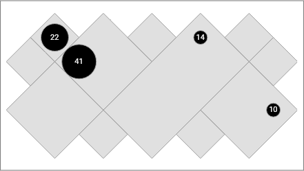
Radius by mapping values
Maps property values to radius values.
MapDataSource polygons =
await MapDataSource .geoJson (geoJson: polygonsGeoJson);
MapLayer polygonsLayer = MapLayer (dataSource: polygons);
_controller.addLayer (polygonsLayer);
MapDataSource points = await MapDataSource .geoJson (
geoJson: pointsGeoJson, keys: ['AN' ], labelKey: 'AN' );
MapLayer pointsLayer = MapLayer (
dataSource: points,
theme: MapTheme (
color: Colors .black,
labelVisibility: (feature) => true ,
markerBuilder: CircleMakerBuilder .map (
key: 'AN' , radiuses: {41 : 25 , 22 : 20 , 14 : 10 , 10 : 10 })));
_controller.addLayer (pointsLayer);
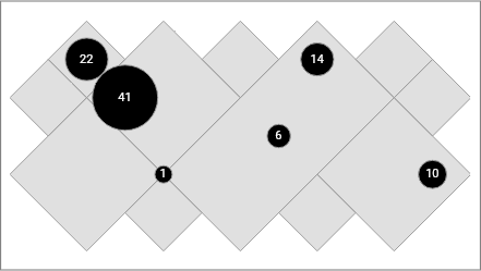
Radius by property values
Uses the property values as radius values.
MapDataSource polygons =
await MapDataSource .geoJson (geoJson: polygonsGeoJson);
MapLayer polygonsLayer = MapLayer (dataSource: polygons);
_controller.addLayer (polygonsLayer);
MapDataSource points = await MapDataSource .geoJson (
geoJson: pointsGeoJson, keys: ['AN' ], labelKey: 'AN' );
MapLayer pointsLayer = MapLayer (
dataSource: points,
theme: MapTheme (
color: Colors .black,
labelVisibility: (feature) => true ,
markerBuilder: CircleMakerBuilder .property (key: 'AN' )));
_controller.addLayer (pointsLayer);
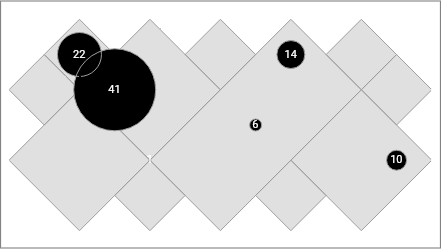
Radius in proportion to property values
MapDataSource polygons =
await MapDataSource .geoJson (geoJson: polygonsGeoJson);
MapLayer polygonsLayer = MapLayer (dataSource: polygons);
_controller.addLayer (polygonsLayer);
MapDataSource points = await MapDataSource .geoJson (
geoJson: pointsGeoJson, keys: ['AN' ], labelKey: 'AN' );
MapLayer pointsLayer = MapLayer (
dataSource: points,
theme: MapTheme (
color: Colors .black,
labelVisibility: (feature) => true ,
markerBuilder: CircleMakerBuilder .proportion (
key: 'AN' , minRadius: 8 , maxRadius: 30 )));
_controller.addLayer (pointsLayer);
Addons
Allows adding components on the map.
Legend
Available customizations:
padding
margin
decoration
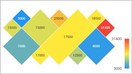
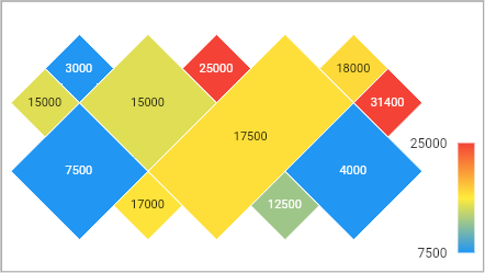
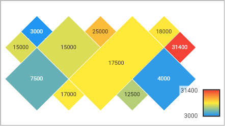
Gradient legend
Legend for gradient themes.
MapDataSource polygons = await MapDataSource .geoJson (
geoJson: geoJson, keys: ['Gts' ], labelKey: 'Gts' );
MapLayer layer = MapLayer (
id: 1 ,
dataSource: polygons,
theme: MapGradientTheme (
contourColor: Colors .white,
labelVisibility: (feature) => true ,
key: 'Gts' ,
colors: [Colors .blue, Colors .yellow, Colors .red]));
_controller.addLayer (layer);
_addons = [GradientLegend (layer: layer)];
VectorMap map = VectorMap (
controller: _controller,
layersPadding: EdgeInsets .fromLTRB (8 , 8 , 56 , 8 ),
addons: _addons);
Gradient legend - Setting min and max values
MapLayer layer = MapLayer (
id: 1 ,
dataSource: polygons,
theme: MapGradientTheme (
contourColor: Colors .white,
labelVisibility: (feature) => true ,
key: 'Gts' ,
min: 7500 ,
max: 25000 ,
colors: [Colors .blue, Colors .yellow, Colors .red]));
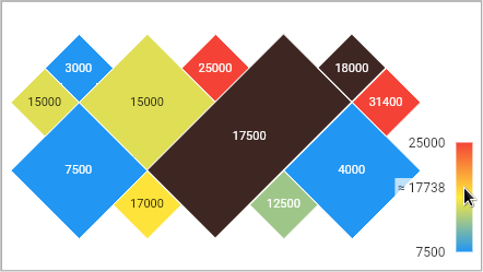
Gradient legend - Highlight
MapLayer layer = MapLayer (
id: 1 ,
dataSource: polygons,
theme: MapGradientTheme (
contourColor: Colors .white,
labelVisibility: (feature) => true ,
key: 'Gts' ,
min: 7500 ,
max: 25000 ,
colors: [Colors .blue, Colors .yellow, Colors .red]),
highlightTheme: MapHighlightTheme (color: Colors .brown[900 ]));
Gradient legend - Customization
Available customizations:
gradient bar width
gradient bar height
gradient bar border
values font size
gap between bar and values
MapLayer layer = MapLayer (
id: 1 ,
dataSource: polygons,
theme: MapGradientTheme (
contourColor: Colors .white,
labelVisibility: (feature) => true ,
key: 'Gts' ,
colors: [Colors .blue, Colors .yellow, Colors .red]));
_addons = [
GradientLegend (
layer: layer,
barBorder: Border .all (width: 2 ),
barHeight: 50 ,
barWidth: 30 )
];
VectorMap map = VectorMap (
controller: _controller,
layersPadding: EdgeInsets .fromLTRB (8 , 8 , 56 , 8 ),
addons: _addons);
Click listener
VectorMap map = VectorMap (
controller: _controller,
clickListener: (feature) {
print ('feature id: ${feature.id} ' );
});
Mode
Auto fit
This is the default mode
VectorMapController _controller =
VectorMapController (mode: VectorMapMode .autoFit);
Pan and zoom
VectorMapController _controller =
VectorMapController (mode: VectorMapMode .panAndZoom);
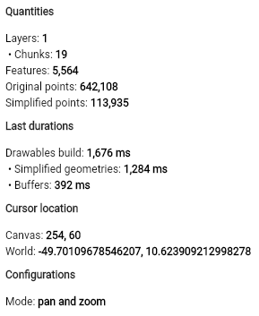
Debugger
Building a debugger
MapDebugger debugger = MapDebugger ();
Binding the debugger on the map
_controller = VectorMapController (debugger: widget.debugger);
Building the debugger widget
MapDebuggerWidget debuggerWidget = MapDebuggerWidget (debugger);
I'm working on
More theming features
More legends
More gradient legend customizations
More addons
Handle line type geometries
Click and mouse hover (need geometry buffer)
Improve the performance of heavy geometries (over 500k points) on mobile devices
Pan limits?
Release the final version (1.0.0). The API may have some small changes.
Support this project
Bitcoin
bc1qhqy84y45gya58gtfkvrvass38k4mcyqnav803h
Ethereum (ERC-20) or Binance Smart Chain (BEP-20)
0x9eB815FD4c88A53322304143A9Aa8733D3369985
Helium
13A2fDqoApT9VnoxFjHWcy8kPQgVFiVnzps32MRAdpTzvs3rq68