
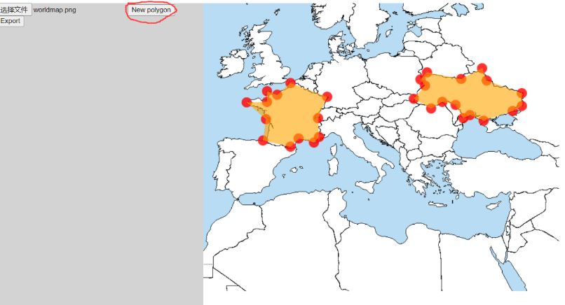
Overview
Flutter Image Map enables interactive image mapping by allowing users to define clickable regions on an image with customizable colors. Inspired by HTML image maps, it supports touch and click interactions across multiple platforms. Developers can easily create responsive, visually engaging maps for applications like navigation, product hotspots, or educational tools. The package integrates seamlessly into Flutter projects and provides a simple API for defining areas and handling user input.
Use cases
- Interactive product images
- Educational diagrams
- Map-based navigation
- Hotspot tutorials
- User interface overlays
Key features
- Customizable colored areas
- Touch and click event handling
- Cross-platform support
- Simple area definition API
- Responsive design integration
Suitable for
- UI designers seeking interactive images
- Educational app developers
- E-commerce product displays
- Web and mobile app creators
- Interactive documentation
Considerations
- Requires manual area coordinate setup
- Limited to static image interaction
- Not suitable for dynamic or animated maps
- Performance may vary with complex shapes
- No built-in zoom or pan functionality