
Overview
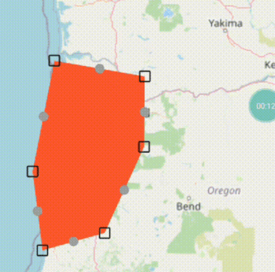
A Flutter package that enables interactive editing of lines and polygons within the flutter_map widget. It provides draggable markers for adjusting vertices, allowing users to create or modify vector shapes directly on a map. Designed for geolocation applications requiring user input on map geometry, it integrates seamlessly with flutter_map's existing features. The editor supports both line and polygon shapes, offering intuitive point manipulation through touch or mouse interactions across all supported platforms.
Use cases
- Map-based shape creation
- Interactive route planning
- Geospatial data annotation
- Polygon boundary editing
- Real-time map drawing
- User-driven map geometry input
Key features
- Draggable vertex markers
- Support for lines and polygons
- Seamless integration with flutter_map
- Cross-platform compatibility
- Real-time shape updates
- Simple API for initialization and event handling
Suitable for
- GIS applications
- Mapping tools with user input
- Interactive map dashboards
- Field data collection apps
- Educational mapping software
- Prototyping map interaction features
Considerations
- Requires flutter_map dependency
- Limited to basic shape editing
- No built-in snapping or alignment
- May need custom styling for markers
- Performance impact with many vertices
- Not suitable for complex geometry operations